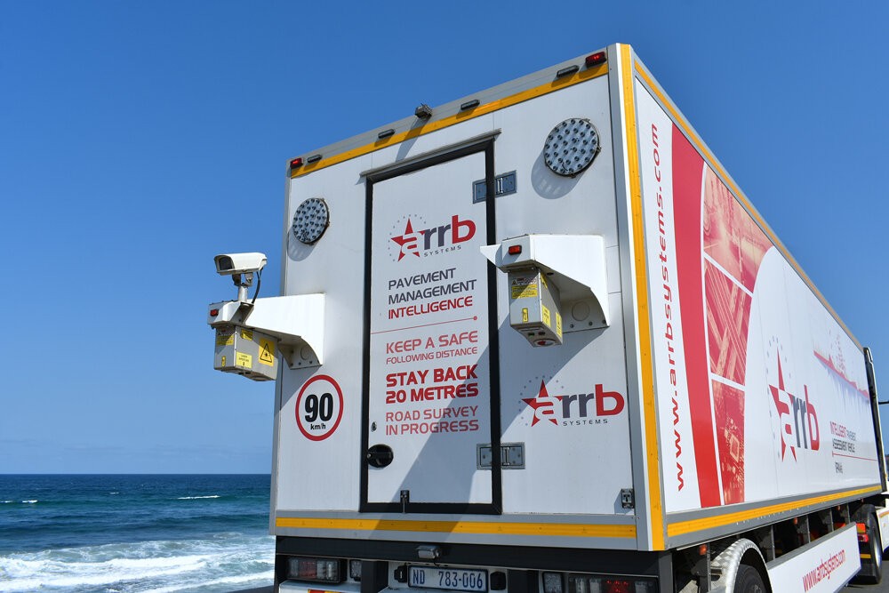
The iPAVe® is the world’s first and only fully integrated pavement assessment system that collects both surface and structural condition data in a single pass — all while traveling at highway speeds. Designed to revolutionize pavement evaluation, iPAVe uncovers hidden subsurface issues like fatigue and bearing capacity weaknesses, enabling better planning, optimized maintenance, and long-term cost savings.
Enquiry
The iPAVe® system is a powerful solution for comprehensive road asset management and lifecycle optimization.
Designed for high-speed, high-resolution measurement, it captures both surface and subsurface pavement conditions at traffic speeds — eliminating the need for traffic control and significantly improving safety and operational efficiency.
With integrated GNSS for accurate spatial mapping and high-quality imaging of road assets such as signs, markings, and structures, iPAVe ensures complete data coverage in a single pass.
Key application areas include pavement fatigue and bearing capacity analysis, deflection profiling, and condition monitoring of cracks, rutting, roughness (IRI), and texture.
It also supports slope, crossfall, and gradient evaluation, as well as asset condition surveys and nationwide road planning.
Available in multiple configurations, iPAVe offers a Standard System for surface and structural capture, an Advanced setup with GNSS and geometry analysis, and an Enterprise Kit tailored for large-scale or national-level projects.