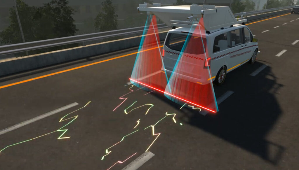
Hawkeye 2000 Survey System
The Hawkeye 2000 Series is a fully integrated, modular, and intelligent road data collection system designed for high-performance surveys across urban, rural, and highway environments. With real-time monitoring, multi-vehicle deployment, and a range of plug-and-play modules, it enables scalable, future-proof solutions for infrastructure audits, safety assessments, and asset mapping. Trusted by government agencies and infrastructure specialists, it’s engineered for precision, speed, and flexibility in any survey scenario.